Dublin Maps and Orientation
(Dublin, Republic of Ireland)
The capital and most densely populated city in the whole of the
Republic of Ireland, Dublin serves as a major Irish transport hub and entry point. In comparison with the rest of the country, the Great Dublin area is quite enormous and completely out of scale, being home to more than 25 percent of the Republic of Ireland.
Dublin city centre is fairly small and quite compact, being relatively easy to find your way around, particularly if you have purchased a pocket-sized map. The streets are clearly signposted and a simple way to get your bearings is to join a guided bus tour when you first arrive.
Maps and Orientation of the City
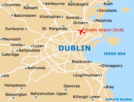
Central Dublin is generally defined as being bounded by the Grand Canal (south) and the Royal Canal (north), being divided by the River Liffey. O'Connell Bridge crosses over the river and connects many popular places of interest. On the southern side of the Liffey, the districts of Temple Bar and Trinity College are especially lively, while the streets of Grafton and Nassau form notable shopping streets.
Henry Street and O'Connell Street reside on the northern side of the River Liffey, where they are also known for their high concentration of shops. Parnell Square, the Busaras bus station and the Connolly Railway Station are all close by.
- Ashbourne - 25 km / 16 miles (35 minutes, north)
- Balbriggan - 36 km / 22 miles (50 minutes, north)
- Celbridge - 19 km / 12 miles (30 minutes, west)
- Drogheda - 57 km / 35 miles (one hour and 15 minutes, north)
- Dun Laoghaire - 13 km / 8 miles (20 minutes, south-east)
- Dunboyne - 24 km / 15 miles (35 minutes, north-west)
- Greystones - 32 km / 20 miles (45 minutes, south)
- Malahide - 17 km / 11 miles (25 minutes, north-east)
- Maynooth - 27 km / 17 miles (40 minutes, west)
- Naas - 29 km / 18 miles (40 minutes, south-west)
- Poulaphouca Reservoir - 40 km / 25 miles (50 minutes, south-west)
- Portmarnock - 16 km / 10 miles (25 minutes, north-east)
- Swords - 18 km / 11 miles (30 minutes, north)
- Wicklow - 48 km / 30 miles (one hour, south)
- Wicklow Mountains National Park - 52 km / 32 miles (one hour and ten minutes, south)
Map of the United Kingdom

Map of Ireland
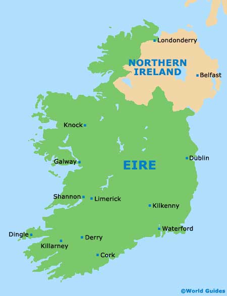
Map of Dublin